When you’re trying to blaze an 1,150-mile trail across a state in which less than 15 percent of the land is in the public domain, you tend to focus on where that 15 percent lies. In the mountains, where more than 1 million acres of public land lies in the Pisgah and Nantahala National Forests, and another half million or so is in the Great Smokies and Blue Ridge Parkway national parks, it’s less of a challenge. No surprise, then, that the longest continuous stretch of the Mountains-to-Sea Trail — 300 miles — is in the mountains.
Finding friendly terrain is more of a challenge in the Piedmont, but with a healthy concentration of State Parks, municipal parks and state game lands it’s been possible to piece together some impressive stretches of trail: 30 miles from Pilot Mountain State Park to Hanging Rock State Park on the Sauratown Trail, 18 miles along the watershed lakes of Greensboro, 12 miles along the Eno River and more than 90 miles along Falls Lake and the Neuse River.
But when you reach the coastal plain, those collections of public lands dwindle. Farmland and livestock operations dominate, making for precious few public passages outside the two-lane country roads linking farm to market.
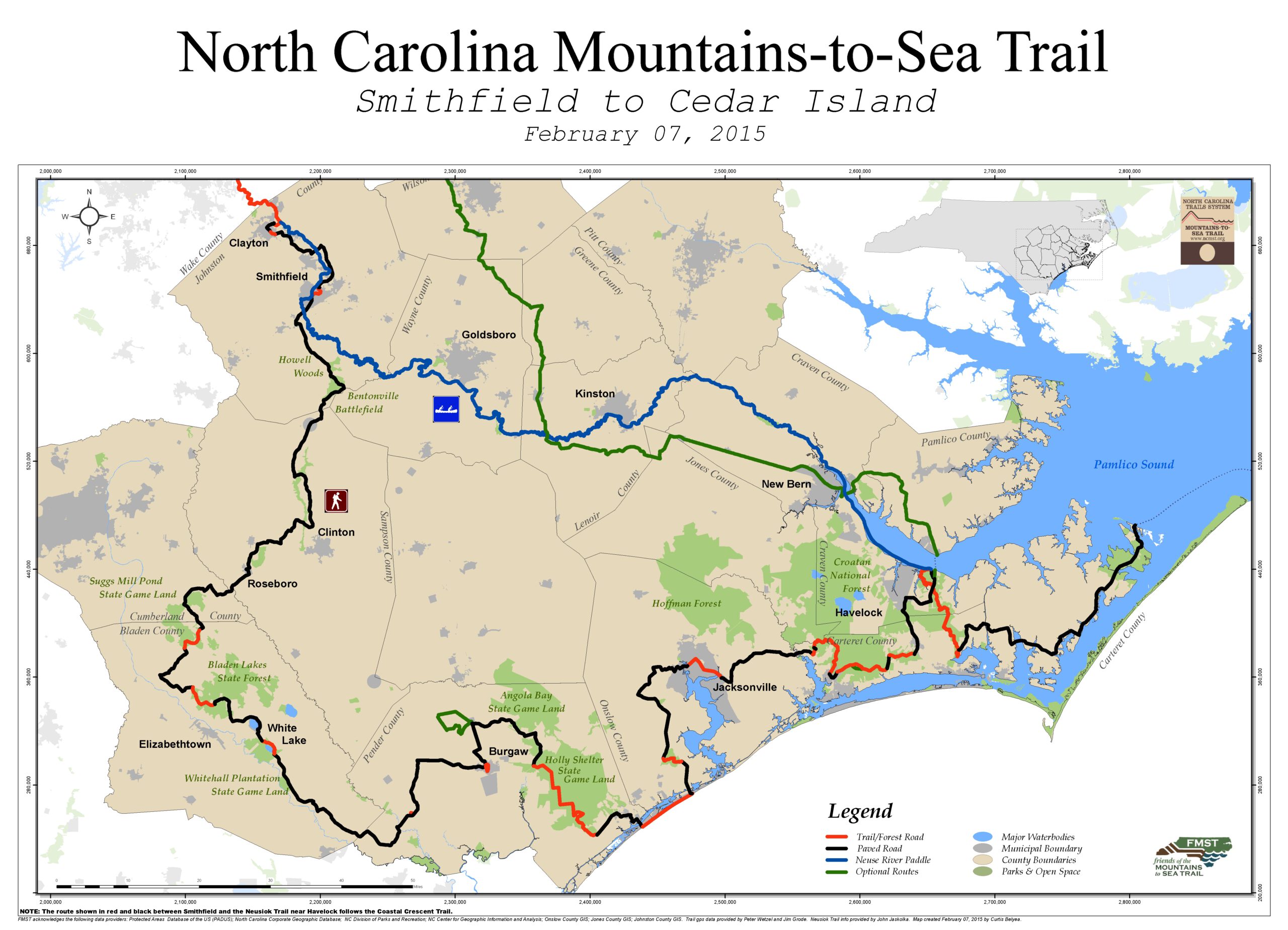
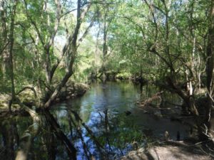
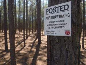
One exception: the 35,000 acres near Elizabethtown made up of Bladen Lakes State Forest, Jones Lake State Park and Turnbull Creek Educational State Forest. Here, the dominance of cotton and soy fields, of pig farms and chicken-coops-turned-condo, give way to open pine savannah and Carolina bays rimmed with dense thickets of vegetation. To walk
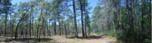
the 7 miles of MST through this area, from Ruskin Road on the north to Turnbull Creek on the south, is to one minute walk through an eerily open savannah where only pines grow and the forest floor is a smooth carpet of pine straw, and the next be enveloped in a tunnel augured through dense swamp growth. It’s a rare hiking opportunity in a state where rare hiking opportunities abound
Carolina bays
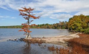
Carolina bays — about a half million, according to N.C. State Parks — once dotted the Southeast. They still do, but the majority of these shallow lakes have since filled with organic matter, resulting in boggy swamps. Of the few remaining water-filled bays in North Carolina, Jones, Salters, Baytree, Singletary, Waccamaw and White lakes are part of the North Carolina State Parks system.
Carolina bays have long held a fascination with the public, in part because no one is quite sure how they came to be. One popular theory: divots resulting from a meteor shower subsequently filled by rain, springs, streams.
In 1911, legislation was passed prohibiting private ownership of land covered by more than 500 acres of lake waters; thus was spared this ribbon of bay land in Bladen, Columbus and Cumberland counties. In 1929 that protection was expanded to include lakes as small as 50 acres.
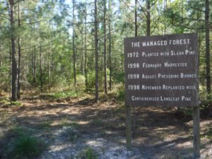
After traveling on country roads much of the way from Smithfield, the MST enters Bladen Lakes State Forest on Ruskin Road in Bladen County on a gated gravel forest road. Straight stretches through pine savannah last for about 4 miles until the MST passes through a gate into Jones Lake State Park; here, you’re thrust into the other world of coastal plain hiking.
Bay swamp community
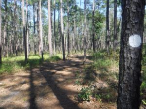
Pick up the Bay Trail in Jones Lake State Park and you enter the cozy-bordering-on-claustrophobic swamp quagmire that rims Jones Lake. While skirting the larger Salters Lake, a 315-acre Carolina bay, which is open by permit only, the 4-mile Bay Trail circles 224-acre Jones Lake (which reaches a depth of just over 8 and a half feet). The evergreen sweet bay, loblolly bay and red bay are so densely packed that you can hike within feet of the late and not realize it: views of the lake are afforded at periodic overlooks.
 The poor drainage in this flat, boggy terrain accommodates a variety of other plant life, including sheep laurel, blueberry and fetterbush, which all thrive in the acidic soil, and pond pocosin, pine and Atlantic white cedar, trees that generally don’t do well in shade but have thrived here as a result of period fires that burn the underbrush — naturally occurring before the area was settled, the result of controlled burns now that the land is state forest and park.
The MST spits out at the Visitor Center, crosses NC 242, then resumes in Turnbull Creek Educational State Forest. At present, the MST skirts the forest on local roads, but eventually will piggyback on a 1.9-mile stretch of trail on the property. Take that stretch today and you’ll be treated to a long stretch along shaded Turnbull Creek, a blackwater creek that rims much of the forest.
Exploring today
Hiking the roughly 7 miles of MST running through Bladen Lakes, Jones Lake and Turnbull Creek makes more sense for a thru-hiker than a day hiker. There’s no parking to the north at the Ruskin Road entrance, and the Turnbull Creek section requires an out-and-back.
Rather, for the purposes of our exploratory hike we will get a sense of the MST by hiking the 4-mile Bay Trail loop at Jones Lake and the 4.5-mile Long Trail loop at Turnbull Creek. Expect flat, save for a 20-foot bluff along Turnbull Creek, and occasionally sandy conditions.