Tradition holds that a ruby makes a nice 40th anniversary gift. Fortunately, the Friends of the Mountains-to-Sea Trail don’t stand on tradition.
Rather than a lone gem stone, the Friends plan to give us a series of gems to celebrate the 40 years since Howard Lee, at the time Secretary of the N.C. Department of Natural Resources and Community Development (now the Department of Natural and Cultural Resources), proposed the trail in 1977. Gems from Asheville uber-hiker Jennifer Pharr Davis to a new package of regional (Mountains, Piedmont, Coastal Plain/Coast) guidebooks to, most significantly for us, a statewide hiking trail that continues to grow.
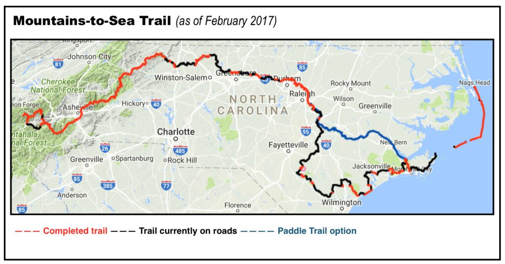
The MST, if you’re not familiar, is a statewide trail-in-progress that will one day bridge Clingman’s Dome on the Tennessee line with Jockey’s Ridge on the Atlantic, a distance of about 1,200 miles. The MST passes through 37 counties, peaks atop 6,684-foot Mount Mitchell (the highest point east of South Dakota’s Black Hills), bottoms out at sea level along the Cape Hatteras National Seashore, passes through 10 state parks, three national forests, four national parks and two national wildlife refuges. To complete the trail requires two ferry rides.
We’re going to write throughout the year about the MST, its anniversary events, its accelerating progress. Today, we’ll start with what every hiker wants to know: where does the trail stand today and where will it be in, say, two years?
First, today. According to Kate Dixon, executive director of the Friends of the Mountains-to-Sea Trail, the pert near all-volunteer group (about 700 volunteers contributed 30,000 hours to the trail in 2015) that’s driving the trail, 680 miles of the trail are complete. The remainder is temporarily situated on mostly country-roads, which explains how 74 hikers have completed the entire trail. Of those 680 miles, about 300 miles are in the mountains, 300 in the Piedmont and about 80 in the coastal plain and coast.
Dixon believes another 30 miles of trail could come on line in the next couple of years. Hot spots of activity are:
- Smokies/Blue Ridge Parkway. From Waterrock Knob east to the Devil’s Garden Overlook, about 300 miles of trail is complete, with most of that along the Blue Ridge Parkway. From Waterrock Knob west, however, there’s a lapse until the trail picks up again in the Great Smoky Mountains National Park. Dixon believes they’re close to getting approvals on trail around a pair of Parkway tunnels. That would make it possible to build trail both along the Parkway and with connecting forest road on Cherokee tribal land. Even if the tunnel trails are approved soon, the terrain is challenging, the construction window limited (April through October): this trail likely would not open within the next couple years.
Hiking the MST along Falls Lake in Raleigh. The trail has a continuous run of 110 miles through the Triangle. Stone Mountain State Park to Elkin. Between 4 and 5 miles of trail currently exist in this corridor on the western fringe of the Piedmont; Dixon believes another 10 milescould open within two years. That would only leave 5 miles left to complete the connection.
- Hanging Rock State Park to Danbury. Currently, the MST runs from west of Pilot Mountain State Park east through the Sauratown Mountains to Hanging Rock State Park. From Hanging Rock, the trail sticks to roadway. But Dixon says the trail is close to extending from Hanging Rock into nearby Danbury, a distance of about 3 miles.
- Guilford County. Heading east and south from Hanging Rock, the trail will pass through the town of Oak Ridge, where about 2 miles exist in Oak Ridge Park, and another 2 could open soon along a recently acquired easement. Farther east in the county, another 4 miles could soon open on the 1,000-acre site of a former prison farm, terrain Dixon describes as “pristine.”
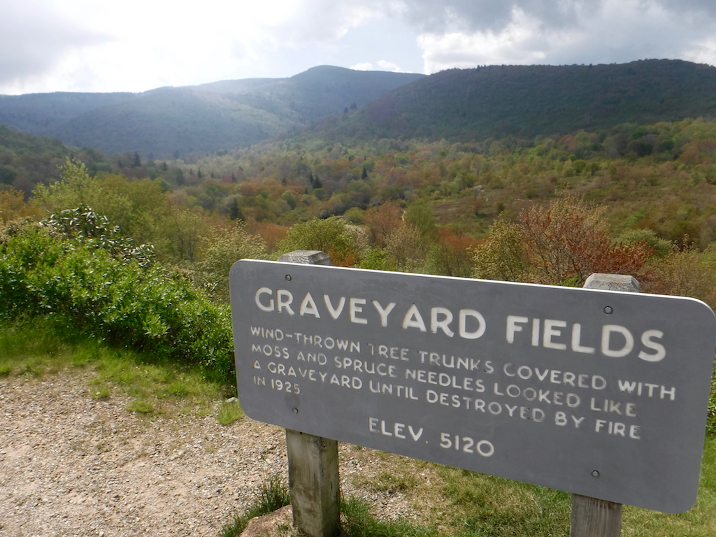
On its 300-mile run through the mountains, the MST passes through Graveyard Fields on the Blue Ridge Parkway. Along the Haw River, where 8 miles of trail runs from above Glencoe to Red Slide Park in Graham, the MST is negotiating to extend the trail another 4 miles south.
- In the Hillsborough area, Orange County planners are expected to release on March 6 a plan for the MST extending west from Occoneechee Mountain State Natural Area into the 7-Mile Creek Area.
- Downstream from Hillsborough, the MST is working to procure easements and start work on trail that would link existing trail at U.S. 70 near the Occoneechee Speedway with trail in the Fews Ford and Pleasant Green access areas of Eno River State Park. From Pleasant Green, the trail runs east for nearly 110 miles, to the town of Clayton.
It may be a while before we can hike 1,175 miles of pure trail. But it won’t be long before we can hike more than 700.