It’s a given that you know what you’ll be doing the afternoon of Monday, Aug. 21. The question is, where will you be doing it?
For as long as 2 minutes and 39 seconds, a swath of South Carolina and North Carolina will be cloaked in darkness sometime between 2:36 p.m. and 2:39 p.m. on Aug. 21 as the moon blots out the sun, the first total solar eclipse in the region since 1506, the last until 2153. It’s a rare opportunity to experience an event that in ancient times sent spasms of horror through the masses, who interpreted the mid-day darkness as a sign that the end was nigh. Today, we take the day off, pack a picnic lunch, put on our special eclipse glasses.
We’ll return with thoughts about how to prepare for your solar eclipse outing. Today, we share our thoughts on where to catch the show. We start with an assumption, a suggestion, and a reminder.
Assumption: Our recommendations assume you’d prefer not to be viewing the eclipse elbow-to-elbow with the rest of humanity.
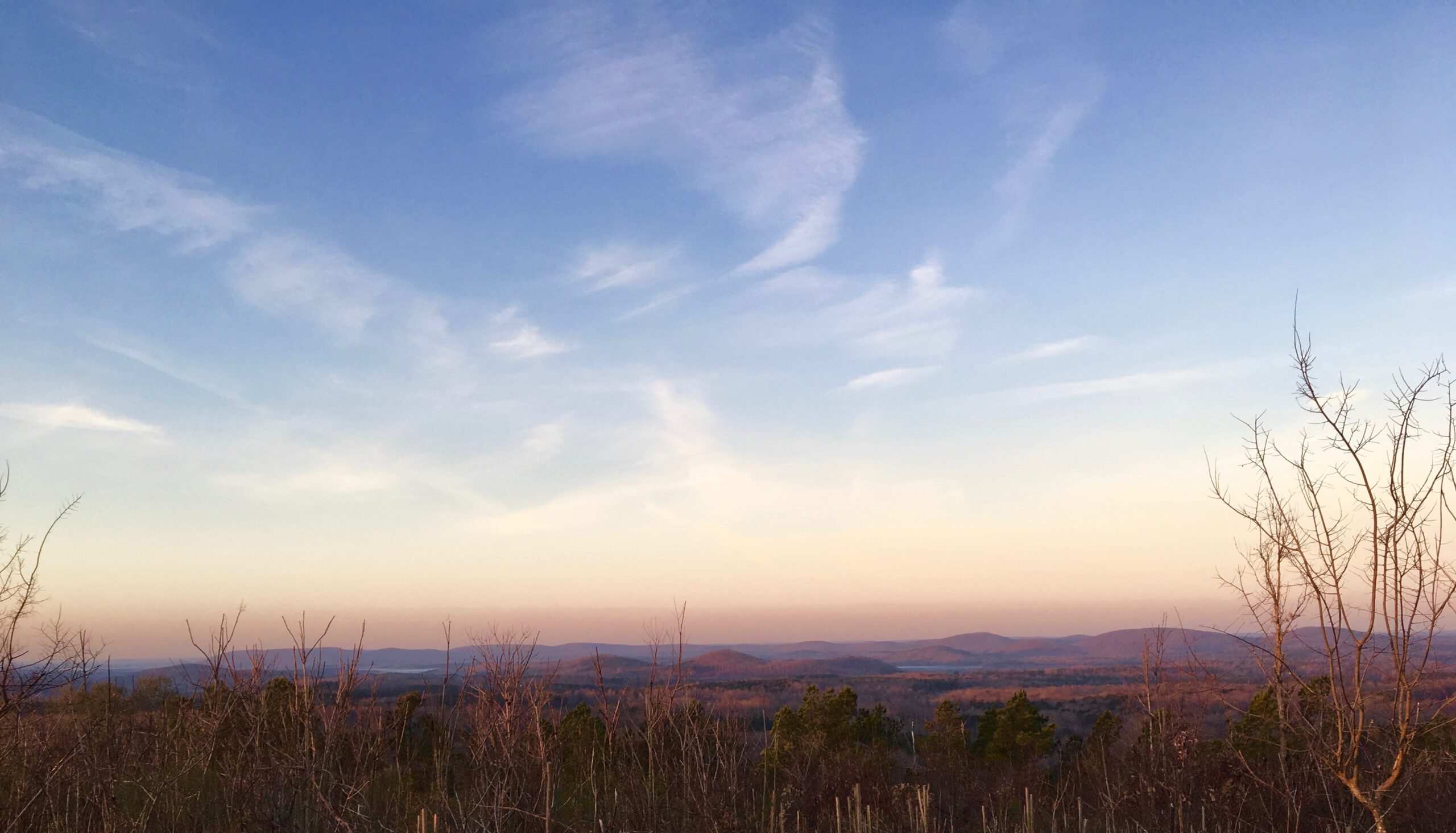
Suggestion: The folks at EclipseWise.com suggest that “a high unobstructed spot in these mountains [of North Carolina] may be an appealing venue to watch the eclipse. The reason is that from a high vantage, you’ll also have the chance to see the surrounding landscape darken and brighten again as totality races across. But be sure to have a clear vantage unobstructed by trees.” (Another advantage to a high peak: on an otherwise cloudy day, you may be above the clouds and have an unobstructed view.)
Reminder: While the eclipse will be total around 2:30 p.m. and last less than three minutes, the transition will begin around 1 p.m. and end around 4 p.m. From previews to credits, it’s a three-hour show.
Our recommended venues.
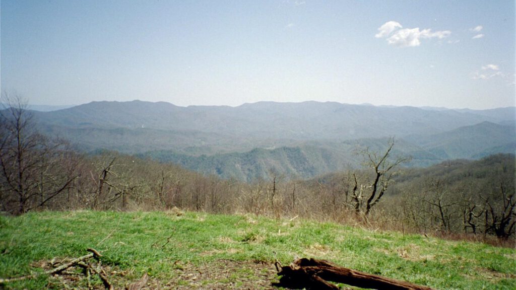
Cheoah Bald, Nantahala National Forest, Wesser. Cheoah Bald, at 5,062 feet, tops a ridgeline that begins near the Nantahala Outdoor Center in Wesser and tops out 8 miles later and 3,800 feet higher — and that’s probably the easiest route. (The climb from the Stecoah Gap access to the Appalachian Trail is 5.5 miles and from U.S. 19 via the Bartram Trail is a laughingly grueling climb up Ledbetter Creek). Plan on an overnight for this one, heading up Sunday. Note: the hike out via the AT to the NOC is a quick, mellow downhill; you could make it down to your car by dark (night dark, not mid-afternoon dark) but take a headlamp all the same. More info here.
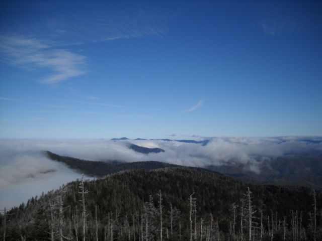
Clingman’s Dome/Andrews Bald, Great Smoky Mountains National Park, Cherokee. Clingman’s Dome!?! you protest. It’s a zoo up there on a normal week day, let alone when there’s a once-every-547-years celestial phenomenon. True, but there’s a National Park Service-sponsored event that sold out in minutes (meaning a manageable crowd); the road to the top will be closed except to shuttle buses. And don’t forget there are trails to the 6,643-foot summit. Our suggestion: Sunday, from the Noland Creek Trailhead hike 4 miles to Campsite #64 (you’ll need a permit). Set up camp. Monday, rise early for the 9-mile hike up Springhouse Branch Trail, Forney Ridge Trail, then Clingman’s Dome Bypass Trail to the top. Or, shave about 2 miles by pulling up at 5,909-foot Andrews Bald on the Forney Ridge Trail. Totally good eclipse viewing either way. For a description of this route, turn to Trip 19 in “Backpacking North Carolina” (UNC Press, 2011).
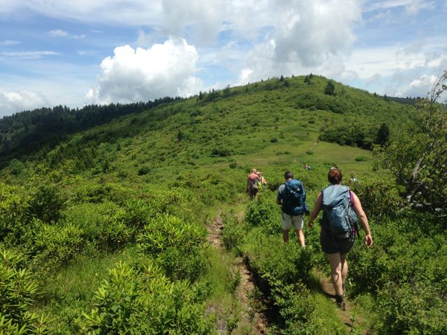
Shining Rock Wilderness, Pisgah National Forest, Waynesville. Shining Rock is on the fringe of totality, meaning you’ll likely be in the dark for a minute to a minute and a half. However, as exposed areas go in the Southeast, you won’t find much more open terrain than in the Shining Rock/Graveyard Fields/Sam Knob area along the Blue Ridge Parkway. Speaking of the parkway, avoid it at all costs: the overlooks will be jammed, the parkway itself will be bumper-to-bumper, and not even renowned New York City parking-place-procuror George Castanza will be able to find a spot in the access areas. Rather, head to the Daniel Boone Boy Scout Camp and take the north end of the Art Loeb Trail 3.7 miles to Deep Gap: it’s a stout climb, be prepared. There, resist the temptation to go left to the summit of Cold Mountain (no views) and go right instead along the Shining Rock Ledge to Shining Rock. Great viewing from atop the white quartz outcrop, and a bit far for the folks coming the opposite direction from the parkway. For a description of this trip, turn to Trip 16 in “Backpacking North Carolina” (UNC Press, 2011).
Standing Indian Mountain, Nantahala National Forest, Franklin. 5,498-foot Standing Indian Mountain has a lovely, intimate, south-facing perch that would be ideal for total eclipse viewing. However, it won’t take many of the campers from the Standing Indian Campground below to occupy that intimacy. No matter, there are plenty of other openings along the AT as it heads north. Generally, Standing Indian sits off the beaten path; the fact that all the reservable campsites are taken for that day suggests that may not be the case on August 21. Take your chances on one of the 84 walk-up sites, or backpack to the top. We recommend taking the 3.7-mile Kimsey Creek Trail from the campground to Deep Gap, then hanging a left (go north) on the AT to Standing Indian and viewing points beyond. More info here.
Little Long Mountain, Uwharrie National Forest, Asheboro. So time doesn’t allow you to devote at least two days to the total eclipse: this isn’t an all-or-nothing proposition. If you can’t drive 5 hours, you’ll still be able to catch a spectacular partial eclipse in the Piedmont. (For a sense of how spectacular, go here.) Perhaps the best spot in the region for viewing is 922-foot Little Long Mountain in the Uwharrie National Forest southwest of Asheville. Little Long is the lone spot on the Uwharrie Trail offering near panoramic views (especially to the west and south, in view of the eclipse’s path). There’s quick access (0.8 miles) via the Joe Moffitt Trailhead, or make it an event and hike in 2.5 miles from Jumpin’ Off Rock trailhead. For information on hiking Little Long Mountain, check out the “Uwharrie Lakes Region Trail Guide,” by Don Childrey (Earthbound Sports, Second edition 2014).
* * *
Looking for a viewing venue that doesn’t require quite as much sweat equity? Check out these suggestions from RomanticAsheville.com.