Our upcoming adventures: Hike, backpack
Hikes
GetHiking! at Night, on the Mountains-to-Sea Trail
Day-Hike Section D, Falls Lake, Raleigh
GetHiking! Triangle
When: Tuesday, Dec. 1, 7 p.m.
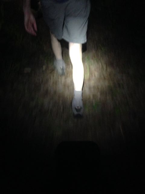 We return to the Mountains-to-Sea Trail for another night hike, this time hiking what the Friends of the Mountains-to-Sea Trail refer to as Day-Hike D, the 2.8-mile stretch between Bayleaf Church Road and Possum Track Road. We’ll start from Bayleaf Church, hike east for 45 minutes, then about-face and return (those good at math will immediately recognize this as a hike of roughly an hour and a half). You need a nightlight for this hike; I’ve a couple loaners, first come/first accommodated — sign up below. This is a somewhat rolling stretch of trail, with a few instances of roots and rocks but generally in good shape. A good first-time hike for the night-hike novice.
Hike leader: Joe Miller
More info and to sign up, go here.
8th Annual Carolina Thread Trail Forum
Charles Mack Citizen Center, Mooresville
GetHiking! Charlotte
When: Thursday, Dec. 3, 8 a.m. – 4:30 p.m.
Wondering how the Carolina Thread Trail is progressing? Linking 15 counties in the Charlotte area with trail is no small task, which is why every year for the past eight, there’s been a Carolina Thread Trail Form to bring together trail experts in the region to discuss how the trail is progressing.
More info and sign up here.
GetHiking! 2nd Annual ‘I Hike for Cookies’ hike
Sycamore Trail, Umstead State Park, Raleigh
GetHiking! Triangle
When: Sunday, Dec. 6, 10 a.m.
Last year, GetHking! Triangle celebrated its 100th hike with a hike and potluck cookie social. We don’t know how many hikes we’re up to now, but it seems fitting all the same to hold another cookie hike. Same place (Umstead State Park), same trail (the 7.2-mile Sycamore Trail), same ground rules (bring cookies, preferably homemade, and cup for hot beverages — we’ll supply the hot chocolate).
Hike leader: Anne Triebert
More info and sign up here.
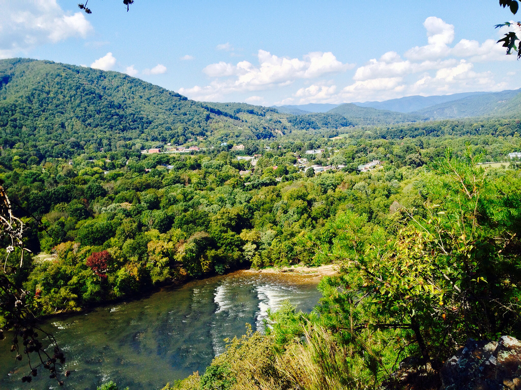
GetHiking! North Carolina’s Classic Hikes: Tanawha Trail
Tanawha Trail / Mountains-to-Sea Trail, Grandfather Mountain
GetHiking! Charlotte, Triad, Triangle
When: Saturday, Dec. 12, 8:30 a.m.
 Think of Grandfather Mountain and you think of a rugged massif known for its jumbled rockscape. Think of Price Lake and your thoughts turn to a more passive mountain landscape with meadows and rolling terrain. Now think of a trail that links the two, exposing the hiker to a variety of mountain ecosystems in a relatively short span of time and you’ve got the Tanawha Trail.
Traversing the southeast flank of Grandfather Mountain, the Tanawha Trail runs for 13.6 miles. The southern section has its ups-and-downs, but there are no severe climbs. Further, since the trail parallels the Blue Ridge Parkway, there are numerous access points, allowing us to offer options of 5.1, 8.5 and 13.6 miles. (Also because the trail parallels the Blue Ridge Parkway, the shuttle is quick and easy.)
We will meet at the Price Lake parking area at Milepost 298 and drive south on the Parkway to the trailhead, at Beacon Heights, dropping shuttle cars at the Raven Rocks Overlook (for the 5.1-mile hikers) and Boone Fork (8.5 milers) parking areas.
This hike is part of our GetHiking! North Carolina’s Classic Hikes series (see below for more information). It will be the 11th hike in this series of 12 hikes in 2015.
This is a fee program; the is a per-hike charge of $25. The fee includes a swag bag, monthly enewsletter and discounts on hiking gear at Great Outdoor Provision Co. You will be sent a PayPal invoice upon signing up for this hike.
Estimated drive time: Charlotte: 2 hours; Greensboro: 2 hours; Raleigh: 3 hours, 10 minutes.
Hike leaders: Joe Miller, Anne Triebert
More info here.
GetBackpacking! on MLK Weekend: ?Backpackers’ choice (see below)
When: Jan. 15-18.
The GetBackpacking! community has spoken: we will spend the Martin Luther King Jr. holiday weekend on the Appalachian Trail.
Late Friday, we will camp on or near Max Patch. Saturday, we will hike about 12 miles to Garenflo Gap (or thereabouts). Sunday, we will continue on into Hot Springs, noodle about a bit, then continue to the Rich Mountain area (about 15 miles). Monday, we hike out, on the Roundtop Ridge Trail, back to Hot Springs, about 5 miles.
Daily mileages will vary depending upon how far we hike in Friday evening (yes, a bit of night hiking is involved). Total distance: 32 miles.
More detailed information will be provided in the December GetBackpacking! enewsletter; if you are not a subscriber, email joe@getgoingnc.com and we’ll get you on the list (it’s free and we don’t distribute our circulation list). You can also find details on this trip in “Backpacking North Carolina” (2011, UNC Press), Trip Nos. 25 & 26.
We will hold a trip planning meeting on Wednesday, Jan. 13 at 6:30 p.m. at the Great Outdoor Provision Co. store in Raleigh’s Cameron Village.
Meanwhile, at our coastal State Parks …
 GetExploring! Greenville is taking a hiatus from leading trips until the after the first of the year. Until then, we’ll clue you in to some great programs at our nearby North Carolina State Parks.
Compass Course, Jones Lake State Park, Elizabethtown.
Improve your wayfinding skills in the wild with this navigation course for newbies. Compasses provided.
When: Saturday, Dec. 5, 10 a.m.
More info here.
South Mills Christmas Parade, Dismal Swamp State Park, South Mills
Check out the floats, including the park’s, in this annual kick-off to the holiday season. Note: this event is in downtown South Mills, not at the park.
When: Saturday, Dec. 5, 11 a.m.
More info here.
Canoe the Pond, Merchants Millpond State Park, Gatesville
One of our favorite adventures — canoeing this 760-acre millpond, paddling amid the water tupelo trees draped with Spanish moss and the bald cypress trees — gets better on this free, ranger-led trip.
When: Sunday, Dec. 6, 1-3 p.m.
More info here.
Nature’s Ornaments, Pettigrew State Park, Columbia
Learn about how nature dudes itself up in winter.
When: Sunday, Dec. 6, 2 p.m.
More info: 252.797.4475
Gear of the week: Patagonia Down Sweater
For the next month or so, our recommendations won’t be about what you should get; rather, what others should get you.
Recently, we read that parents should buy no more than four Christmas gifts per kid, and that the four gifts should be: 1) something they need, 2) something they want, 3) a surprise, 4) something else (whatever!). This week’s recommendation, the Patagonia Down Sweater, covers all four gift-receiving categories.
First, you need it: it’s water-repellant recycled polyester ripstop shell and 800-fill-power down will keep you warm and dry on a winter hike. (Plus, that down is 100 percent “Traceable Down” — European goose down that can be traced to birds that were never force-fed or live-plucked.) Second, you want it because it’s both stylish and functional. Third, it would come as a surprise because it’s a little pricey ($229) and you might not spring for it yourself. And fourth — well, come up with your own fourth reason for scoring this coat. It shouldn’t be hard.
Tip of the week: Exercise your options
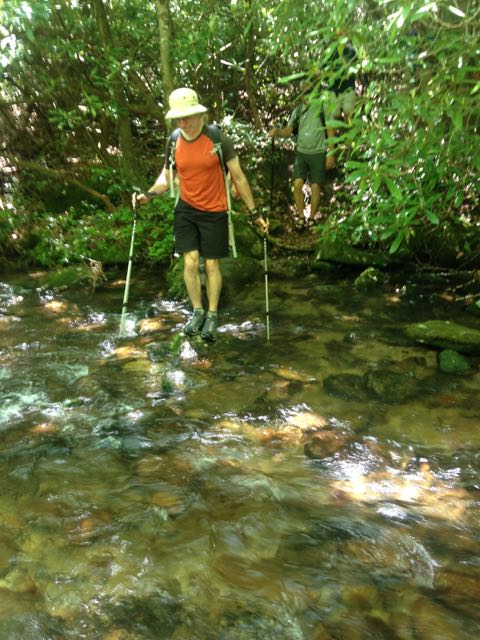 Last Saturday, on our GetBackpacking! graduation trip to South Mountains State Park we weren’t 10 minutes down the trail when we ran into a creek that was flowing mightily. I’d crossed Kathy Creek maybe a dozen times and it had always been an easy rock-hop. That was largely the case this time, save for a five-foot stretch in the middle where two inches of water poured over mossy rock. As I contemplated the crossing there was complete quiet behind me. “We can’t cross this,” I finally announced, prompting the release of 30 seconds or so of collectively held breath.
I knew almost immediately this crossing was a bad idea for 11 people unaccustomed to hiking with 35 pounds on their backs; what took a sec was to figure out the best alternative. Fortunately, we had several, which is almost always the case when you run into a situation you’re uncomfortable with on the trail. In our case, 50 yards back down the Possum Trail was another trail, H.Q., that would head us in the direction we wanted to go. A bit more of a retreat, our map revealed, was another option, which was longer but appeared to avoid water crossings. We also could have retreated farther, for yet a third option. (Unsaid is the point that you should always carry a map.)
The point: especially in winter when the stakes are higher (cold, wet, diminished daylight), it’s important to be flexible. Challenging yourself is one thing, taking unnecessary risk is another. This time of year, it’s best to err on the side of caution.
Resource of the Week: Road closures
We’re getting into that time of year when weather can close roads and destinations. Here are some handy links to check before heading out in winter weather: