
We realize that our extensive database of hikes can be daunting. And in these times of limited petrol, the last thing we want to do is daunt you further.
So in our weeklong effort to help you find a hike near home, one that won’t drain the tank, we’ve pulled together 10 of our favorite hikes near where you live. We give you a snapshot, then provide a link to where you can quickly find specifics on how to make the hike happen.
1. Loblolly/Reedy Creek/Reedy Creek loop trail
Umstead State Park, Raleigh
4.2 miles (loop)
Begin with a long, gradual downhill on a largely new stretch of the Loblolly Trail to get warmed up (and much of the remainder was redone about three years ago). At the 2.3-mile mark, go left on the Reedy Creek bike and bridle trail — a wide, smooth surface of finely crushed gravel — for a mile-long downhill, then left again on the Reedy Creek Lake bike and bridle trail for a mile-long climb back to the trailhead.
More info and directions, here.
2. Piedmont Trail
Lake Brandt, Greensboro
2.75 miles (one way)
More than 40 miles of trail rim the Greensboro watershed lakes of Brandt, Townsend and Higgins; we like this one because it’s easy to find, with the trailhead (and parking) just off Strawberry Road. It’s also flat and well-marked, with few distraction trails to lead you astray. Start in a forest and field draped in kudzu, proceed into a bottomland forest, with frequent breaks offering peeks at the lake.
More info and directions, here.
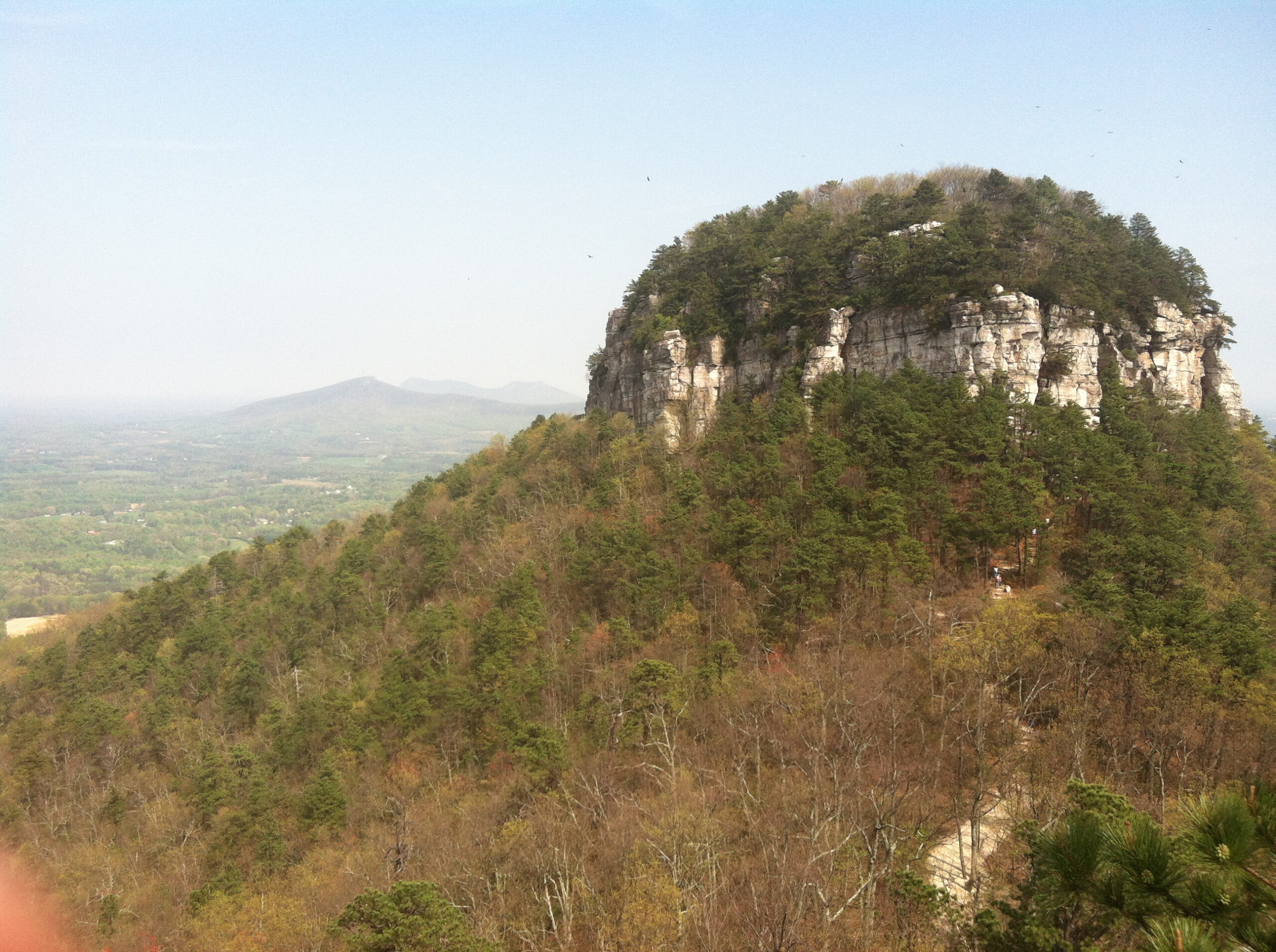
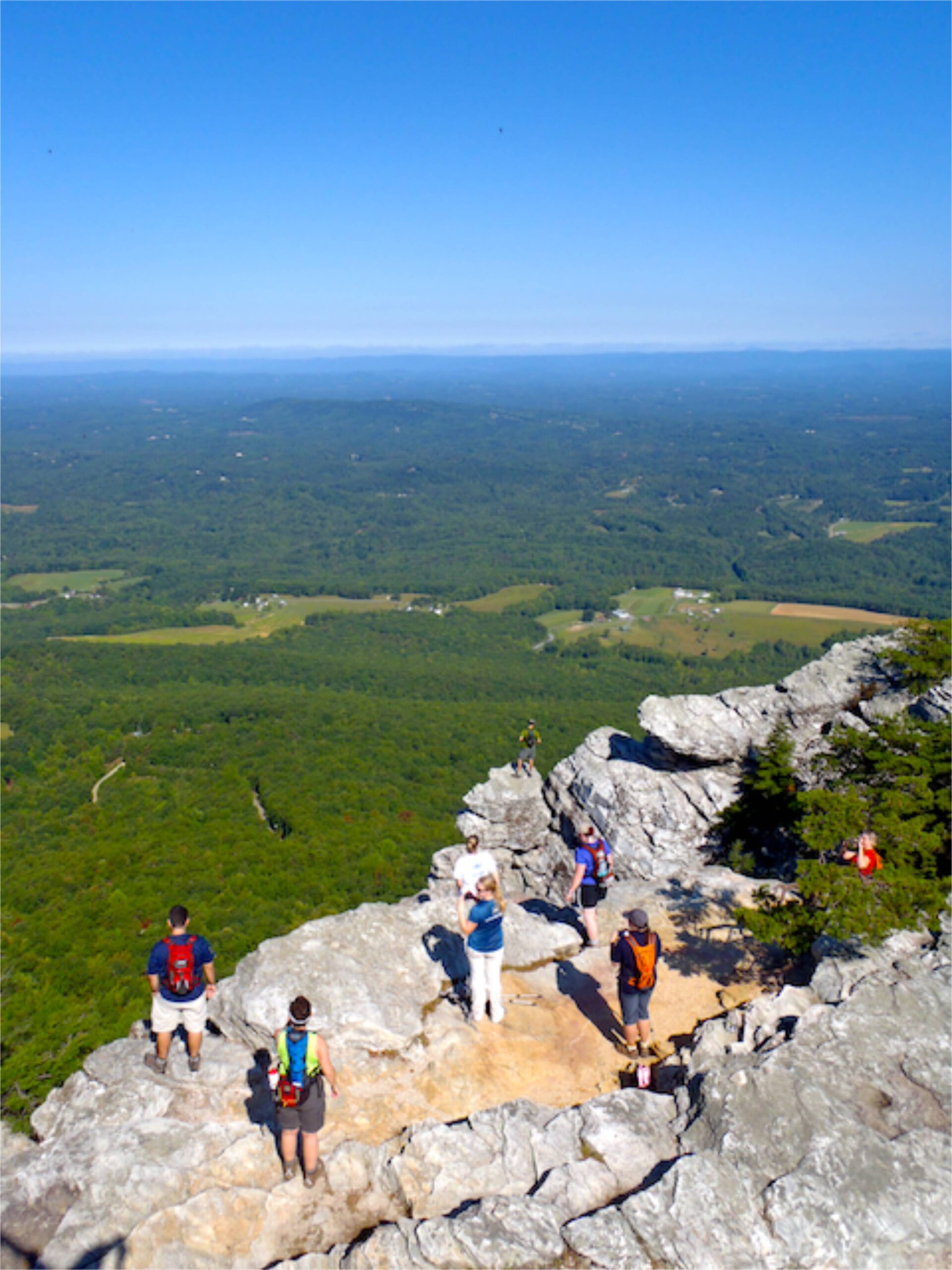
3. Ledge Spring Trail
Pilot Mountain State Park, Pinacle (north of Winston-Salem)
2.4 miles (loop)
After a long descent, the trail veers left and follows the bace of a cliff face that’s home to some of the best rock climbing in the region on routes the likes of Three Bears, Little Amphitheater, Pool Hall, among others. Oh, and there are views to the valley floor below and the Blue Ridge mountains to the west. Return to the top and take the 0.8-mile Jomeokee loop, which circles the park’s trademark Big Pinnacle.
More info and directions, here.
4. Hill Trail
Latta Plantation Nature Preserve, Charlotte
2.7 miles (one way)
Charlotte’s network of nature preserves offers great wilderness escapes without leaving town. At Latta Plantation on Mountain Island Lake, the 16 miles of trail include the Hill Trail, which runs the length of the park, from south to north. One of its key features is the Piedmont prairie it visits along the way, a vast plain of grass and wildflowers where bison once roamed..
More info and directions, here.
5. Buckquarter Creek/Holden Mill figure 8 loop
Eno River State Park / Fews Ford Access, Orange County
4.1 miles
Not sure if you’re up for 4.1 miles? Hike three quarters of a mile on the Buckquarter Creek Trail and if you decide you’re losing steam, nix the bridge crossing to the 2.6-mile Holden Mill Loop. Both trails include passage along the rocky Eno River and climbing along a ridgeline.
More info and directions, here.
6. Little River Regional Park
Durham/Orange County line
1.2 to 7 miles
Opened in 2004, this 391-acre park includes 7 miles of hiking trail and 7 miles of mountain bike trail. Separate but equal, both networks use use the park’s geography to their separate advantages. Despite some steep slopes, the hiking trail is content to take it’s time getting up to the ridgeline — and back down. All the better for savoring this rich preserve.
More info and directions, here.
7. Hanging Rock State Park
Danbury (just north of Greensboro and Winston-Salem)
Less than half mile to 10 miles
You can get darn near any hiking experience you want at Hanging Rock. You want views? Take the 1.3-mile Hanging Rock Trail to its namesake summit, or the more challenging (and less crowded) 4.2-mile Moore’s Wall Trail to Moore’s Knob, both with great 360-degree views. Three shorter trails explore the park’s waterfalls.
More info and directions, here.
8. Goose Creek State Park
Washington
7 miles of trail
To the unaware, the Greenville area would appear devoid of good hiking opportunities. Those in the know, though, know that just a short drive down US 264 is Goose Creek State Park, with 7 miles of trail exploring swamp, coastal forest and the Pamlico River. Your adventure begins from the Visitor Center on the Palmetto Boardwalk, which lifts you through a healthy black gum and cypress swamp. From there, you have a range of options: be sure to pick up a park map.
More info and directions, here.
9. Occoneechee Mountain Mountain State Natural Area
Hillsborough
3.5 miles
You’ll find more ecological escape packed into this 190-acre preserve on the outskirts of Hillsborough than anywhere else in the Triangle. Occoneechee Mountain has five distinct ecological zones, all of which you’ll encounter on this loop that encompasses the Occoneechee Mountain Loop, Overlook, Summit and Brown Elfin Knob trails. The diversity of the mountain — topping out at 867 feet and representing the highest spot in the Triangle, Occoneechee does qualify for mountain status — makes for some unique sitings.
More info and directions, here.
10. Eno River: Cabe Lands to West Point Trail
Durham
8 miles (shorter options possible)
The beauty of the Eno River is that it’s so close to civilization, yet so far. The Eno spends much of its 40 miles running through the heart of Durham, yet you’re largely sequestered on a stretch of water that’s more Appalachian than Piedmont. The Eno itself is surprisingly rocky and the terrain along the banks includes ridgeline stretches that rise high above the river. You’ll get a good feel for the Eno on this 8-mile stretch between the Cabe Lands Access of Eno River State Park and Durham’s West Point on the Eno city park.
More info and directions, here.